
Cotuit 🇺🇸
-
Nautical Twilight begins:04:27 amSunrise:05:35 am
-
Sunset:07:42 pmNautical Twilight ends:08:50 pm
-
Moonrise:03:20 am
-
Moonset:02:26 pm
-
Moon over:08:53 am
-
Moon under:09:05 pm
-
Visibility:26%
-
 Waning Crescent
-
Distance to earth:363,640 kmProximity:98.7 %
Moon Phases for Cotuit
-
good Day
-
minor Time:02:20 am - 04:20 am
-
major Time:07:53 am - 09:53 am
-
minor Time:01:26 pm - 03:26 pm
-
major Time:08:05 pm - 10:05 pm
Tide Clock
Tide Graph
Times
| Tide | Time | Height |
|---|---|---|
| low | 01:49 am | 0.23 ft |
| high | 08:15 am | 2 ft |
| low | 02:25 pm | 0.03 ft |
| high | 08:57 pm | 1.94 ft |
| Date | Major Bite Times | Minor Bite Times | Sun | Moon | Moonphase | Tide Times |
|---|---|---|---|---|---|---|
|
Fri, 03 May
|
07:53 am -
09:53 am
08:05 pm -
10:05 pm
|
02:20 am -
04:20 am
01:26 pm -
03:26 pm
|
R: 05:35 am S: 07:42 pm |
R: 03:20 am S: 02:26 pm |
Waning Crescent |
low: 01:49 am
, 0.23 ft
high: 08:15 am
, 2 ft
, Coeff: 111
low: 02:25 pm
, 0.03 ft
high: 08:57 pm
, 1.94 ft
, Coeff: 104
|
|
Sat, 04 May
|
08:43 am -
10:43 am
08:55 pm -
10:55 pm
|
02:44 am -
04:44 am
02:43 pm -
04:43 pm
|
R: 05:34 am S: 07:43 pm |
R: 03:44 am S: 03:43 pm |
Waning Crescent |
low: 02:52 am
, 0.13 ft
high: 09:19 am
, 2.03 ft
, Coeff: 114
low: 03:22 pm
, -0 ft
high: 09:53 pm
, 2.07 ft
, Coeff: 117
|
|
Sun, 05 May
|
09:33 am -
11:33 am
09:45 pm -
11:45 pm
|
03:07 am -
05:07 am
04:00 pm -
06:00 pm
|
R: 05:32 am S: 07:44 pm |
R: 04:07 am S: 05:00 pm |
Waning Crescent |
low: 03:52 am
, -0.03 ft
high: 10:19 am
, 2.07 ft
, Coeff: 117
low: 04:15 pm
, -0.07 ft
high: 10:46 pm
, 2.2 ft
, Coeff: 129
|
|
Mon, 06 May
|
10:24 am -
12:24 pm
10:38 pm -
12:38 am
|
03:31 am -
05:31 am
05:18 pm -
07:18 pm
|
R: 05:31 am S: 07:46 pm |
R: 04:31 am S: 06:18 pm |
New Moon |
low: 04:48 am
, -0.16 ft
high: 11:16 am
, 2.13 ft
, Coeff: 123
low: 05:07 pm
, -0.1 ft
high: 11:36 pm
, 2.33 ft
, Coeff: 142
|
|
Tue, 07 May
|
11:18 am -
01:18 pm
11:02 pm -
01:02 am
|
03:58 am -
05:58 am
06:38 pm -
08:38 pm
|
R: 05:30 am S: 07:47 pm |
R: 04:58 am S: 07:38 pm |
New Moon |
low: 05:42 am
, -0.26 ft
high: 12:10 pm
, 2.13 ft
, Coeff: 123
low: 05:56 pm
, -0.1 ft
|
|
Wed, 08 May
|
12:13 pm -
02:13 pm
11:54 pm -
01:54 am
|
04:29 am -
06:29 am
07:57 pm -
09:57 pm
|
R: 05:29 am S: 07:48 pm |
R: 05:29 am S: 08:57 pm |
New Moon |
high: 12:25 am
, 2.4 ft
, Coeff: 148
low: 06:33 am
, -0.33 ft
high: 01:02 pm
, 2.13 ft
, Coeff: 123
low: 06:45 pm
, -0.07 ft
|
|
Thu, 09 May
|
12:45 am -
02:45 am
01:09 pm -
03:09 pm
|
05:07 am -
07:07 am
09:12 pm -
11:12 pm
|
R: 05:28 am S: 07:49 pm |
R: 06:07 am S: 10:12 pm |
New Moon |
high: 01:13 am
, 2.4 ft
, Coeff: 148
low: 07:23 am
, -0.33 ft
high: 01:52 pm
, 2.07 ft
, Coeff: 117
low: 07:33 pm
, -0.03 ft
|


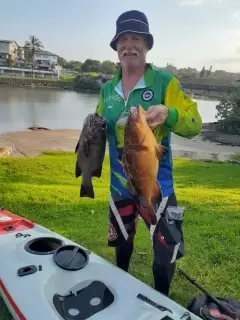
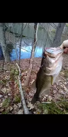
uploaded by: Andretheone

uploaded by: John Needham

uploaded by: Lee Smith 1

uploaded by: D2Turnt

uploaded by: PT Edward fisher

uploaded by: Charlie Pifer

uploaded by: Charlie Pifer

uploaded by: Charlie Pifer

uploaded by: Charlie Pifer

uploaded by: bariu
Best Fishing Spots in the greater Cotuit area
Beaches and Bays are ideal places for land-based fishing. If the beach is shallow and the water is clear then twilight times are usually the best times, especially when they coincide with a major or minor fishing time. Often the points on either side of a beach are the best spots. Or if the beach is large then look for irregularities in the breaking waves, indicating sandbanks and holes. We found 14 beaches and bays in this area.
Cotuit Bay - 1km , Oyster Harbors Beach - 2km , Shoestring Bay - 2km , West Bay - 3km , North Bay - 3km , Popponesset Bay - 3km , Ockway Bay - 4km , Wianno Beach - 5km , East Bay - 6km , Phinneys Bay - 6km , Dowses Beach - 6km , Long Beach - 7km , Scudder Bay - 7km , Craigville Beach - 7km
Harbours and Marinas can often times be productive fishing spots for land based fishing as their sheltered environment attracts a wide variety of bait fish. Similar to river mouths, harbour entrances are also great places to fish as lots of fish will move in and out with the rising and falling tides. There are 1 main harbours in this area.
Cotuit Anchorage - 3km
We found a total of 99 potential fishing spots nearby Cotuit. Below you can find them organized on a map. Points, Headlands, Reefs, Islands, Channels, etc can all be productive fishing spots. As these are user submitted spots, there might be some errors in the exact location. You also need to cross check local fishing regulations. Some of the spots might be in or around marine reserves or other locations that cannot be fished. If you click on a location marker it will bring up some details and a quick link to google search, satellite maps and fishing times. Tip: Click/Tap on a new area to load more fishing spots.
Lewis Pond - 1km , Noisy Point - 1km , Bluff Point - 1km , Cotuit Bay - 1km , Handy Point - 1km , Sampsons Island - 1km , Eagle Pond - 2km , Dead Neck - 2km , Tims Point - 2km , Tims Cove - 2km , Osterville Grand Island - 2km , Oyster Harbors Beach - 2km , Crocker Neck - 2km , Shoestring Bay - 2km , Seapuit River - 2km , Pinquickset Cove - 2km , Rushy Marsh Pond - 2km , Mashpee Neck - 3km , Amos Pond - 3km , Gooseberry Island - 3km , Naomi Pond - 3km , West Bay - 3km , North Bay - 3km , Cotuit Anchorage - 3km , Little Island - 3km , Pine Island - 3km , Combs Pond - 3km , Saint Marys Island - 3km , Ryefield Point - 3km , Popponesset Bay - 3km , Point Isabella - 3km , Prince Cove - 3km , Eel River - 4km , Lovells Pond - 4km , Meadow Point - 4km , Mill Pond - 4km , Ockway Bay - 4km , Daniels Island - 4km , Dam Pond - 4km , Parker Pond - 4km , Little Thatch Island - 4km , Ishem Pond - 4km , Pocknett Neck - 4km , Popponesset Island - 4km , Punkhorn Point - 4km , Briants Neck - 4km , Santuit Pond - 4km , Wianno Head - 4km , Bog Pond - 4km , Anns Cove - 4km , Thatch Island - 4km , Baxter Neck - 4km , Sam Pond - 5km , Mashpee River Dam - 5km , Micah Pond - 5km , Pattys Pond - 5km , Wianno Beach - 5km , Crystal Lake - 5km , Joshua Pond - 5km , Washburn pond - 5km , Neck Pond - 5km , Long Pond - 6km , Martha Pond - 6km , Witch Pond - 6km , Coleman Pond - 6km , East Bay - 6km , Sams Cove - 6km , Jim Pond - 6km , Phinneys Bay - 6km , Hamblin Pond - 6km , Osterville Point - 6km , Dowses Beach - 6km , Uncle Georges Cove - 6km , North Pond - 6km , Dean Pond - 6km , Muddy Pond - 6km , West Pond - 6km , Red Brook Road Dam - 7km , Long Beach - 7km , Lumbert Pond - 7km , Mashpee Pond - 7km , Middle Pond - 7km , Moody Pond - 7km , Great Neck - 7km , Centerville Harbor - 7km , Carsley Neck - 7km , Round Pond - 7km , Flashy Pond - 7km , Eleanors Cove - 7km , Cleveland Island - 7km , Conaumet Cove - 7km , Conaumet Neck - 7km , Scudder Bay - 7km , Mystic Lake - 7km , Tim Pond - 7km , Succonnesset Point - 7km , Lily Pond - 7km , Craigville Beach - 7km , James Pond - 7km
Comments